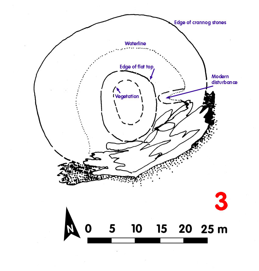
Crannog 3 Loch Awe[click on graphics for larger view in new window] |
Location: B‡rr Phort
Map reference: NM 964 105
Date of Survey: 27 September 1972
Loch level OD: 35.448 m
Highest point of crannog OD: 36.648 m
Top to bottom of crannog: 5.95 m
Overall spread: 37 m x 29 m
Usable area: 15.5 m x 11.5 m
Description (1972): Crannog adding to natural bedrock and natural island. Extensive very steep stone facings on N and W sides. Natural ridge to south stretches away from bedrock.
Artificial boat-shaped depression, probably modern 'harbour' on E side, shown by lack of weathering of stones. Central area of crannog appeared to have beeen built up. Grass and trees on highest area. In a deep bay with no visible causeway
Finds: Triangular stone 0.25 m x 0.20 m x 0.10 m with narrow sharpening groove in it, on W side of top
Dating:
Post-1972:
CLICK TO ENLARGE
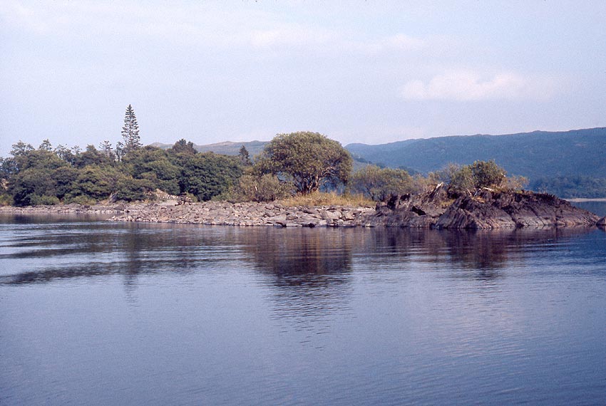
Crannog 3 was backed by bedrock
Back to front page